

El Niño forecast 2027 hottest year
BanksiaPulse reports that climatologists are watching a developing system with increasing alarm, with most Australian capital cities facing at least an 80% chance of an unusually warm and dry spring. This looming weather event is linked to the potential for a ‘Super El Niño’ that could make 2027 the hottest year on record, according to the Bureau of Meteorology. Understanding the implications of such a powerful climate driver is crucial for Australians preparing for significant shifts in weather patterns, agricultural yields, and potentially, insurance premiums.
- What is El Niño and how does it affect global weather patterns?
- Why is the 2027 Super El Niño expected to be stronger than previous events?
- How accurate are El Niño forecasts from the Bureau of Meteorology?
- What regions will be most impacted by the predicted 2027 Super El Niño?
- How does a Super El Niño compare to regular El Niño events?
- What are the potential risks of a record-breaking El Niño in 2027?
- How can businesses and communities prepare for an extreme El Niño event?
What is El Niño and how does it affect global weather patterns?
El Niño is a naturally occurring climate phenomenon characterized by the warming of sea surface temperatures in the central and eastern tropical Pacific Ocean. This warming disrupts typical atmospheric circulation patterns, leading to widespread changes in weather across the globe. In Australia, El Niño generally results in below-average rainfall and above-average temperatures, particularly across the eastern and southern parts of the continent. This can manifest as increased bushfire risk, drought conditions impacting agriculture, and reduced water availability. The contrast to El Niño is La Niña, which typically brings wetter and cooler conditions to Australia. These cycles, part of the broader El Niño-Southern Oscillation (ENSO) phenomenon, operate on irregular time scales of roughly 2 to 7 years, influencing global weather systems for months at a time and significantly impacting diverse ecosystems and human activities worldwide. BanksiaPulse will continue tracking El Niño forecast in Australia as new developments emerge.
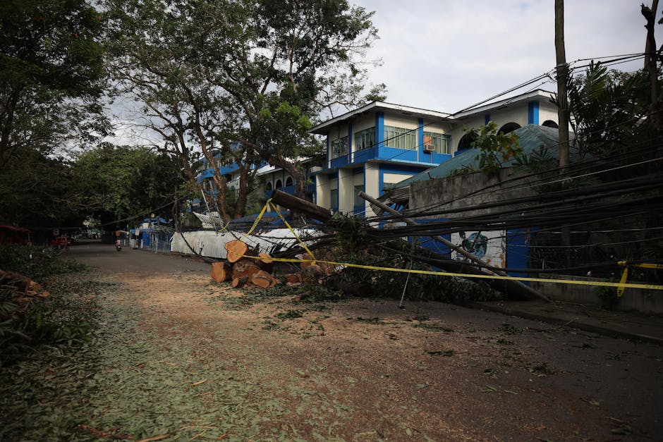
The shift in Pacific Ocean temperatures doesn’t just affect local marine life; it has far-reaching consequences for atmospheric rivers, jet streams, and storm tracks. For instance, the altered sea surface temperatures can weaken the easterly trade winds across the Pacific, a crucial component of the ENSO cycle. This weakening allows warm water to continue accumulating in the east, further amplifying the warming trend. Consequently, the atmospheric response cascades globally. Regions that typically experience monsoon seasons might see them weakened or delayed, while others could face more intense heatwaves or altered storm frequencies. Understanding this complex interplay between ocean and atmosphere is vital for predicting the specific impacts on regions like Australia. The predictability of El Niño’s global impact has improved significantly over the decades, thanks to enhanced climate modelling and a deeper understanding of the underlying oceanic and atmospheric processes. However, the precise intensity and duration of each event, and therefore its specific regional consequences, can still vary. For Australia, the implications extend beyond immediate weather concerns to long-term economic and environmental stability. The agricultural sector, heavily reliant on predictable rainfall patterns, faces significant challenges, potentially leading to reduced crop yields and increased food prices. Similarly, water resource management becomes a critical concern, with prolonged dry spells straining supply for both urban and rural communities.
Why is the 2027 Super El Niño expected to be stronger than previous events?
The prospect of a ‘Super El Niño’ in 2027 stems from a confluence of factors that suggest an event of exceptional intensity, potentially exceeding those seen in recent decades. Climatologists are observing the early development stages of a system that exhibits characteristics associated with a more powerful El Niño. This includes the potential for exceptionally warm sea surface temperatures across the Pacific, a key indicator of El Niño strength. Current monitoring suggests these ocean temperatures could reach levels comparable to or even surpass those observed during historically significant El Niño events, such as those in 1982-83 and 1997-98. The Bureau of Meteorology’s analysis indicates a high probability that if these conditions persist and intensify as predicted, the resulting atmospheric response could lead to more extreme weather impacts globally and particularly in Australia.

One of the primary drivers for the potential strength of the 2027 El Niño forecast lies in the underlying state of the Pacific Ocean. Sophisticated climate models, which have become increasingly adept at forecasting these complex phenomena, are projecting a significant buildup of heat in the tropical Pacific. This heat acts as the fuel for the El Niño event. Furthermore, the current oceanic and atmospheric conditions show patterns that align with the precursors of strong El Niño events. Scientists are meticulously tracking specific indices, such as the Multivariate ENSO Index (MEI), which combines several atmospheric and oceanic variables to provide a comprehensive measure of ENSO’s strength. A sustained high value in such indices signals a robust developing event. The term ‘Super El Niño’ itself is not an official meteorological classification but is used by scientists to describe events that are significantly stronger than average and can lead to more extreme global weather consequences. These events are rare, occurring perhaps once a decade or less. The combination of a rapid development, exceptionally high sea surface temperatures, and a prolonged duration contributes to the likelihood of a ‘Super El Niño’. The implications for Australia are particularly concerning, as stronger El Niño events typically correlate with more severe droughts, increased heatwaves, and a higher risk of widespread bushfires. The economic and social ramifications of such an event underscore the importance of proactive preparation and adaptation strategies for communities across the nation.
How accurate are El Niño forecasts from the Bureau of Meteorology?
The Bureau of Meteorology (BoM) is a world-leading authority in climate forecasting, and their El Niño predictions have a strong track record of accuracy, particularly in identifying the onset and general characteristics of events. The BoM utilises a sophisticated network of ocean buoys, satellites, and weather models to continuously monitor the Pacific Ocean and atmosphere. Their forecasts are based on extensive historical data and advanced climate modelling, which allows them to predict the likelihood of El Niño developing with increasing confidence as the season progresses. While pinpointing the exact timing and severity of every El Niño event remains a challenge due to the inherent complexity of climate systems, the BoM’s outlooks provide essential guidance for governments, industries, and the public.
The BoM’s seasonal forecasts typically provide probabilities for different climate scenarios, such as the likelihood of El Niño developing and its potential intensity. For instance, the BoM often issues statements indicating an “increased chance” or “high probability” of an El Niño event forming, which has proven to be a reliable indicator. For example, in the lead-up to past El Niño events, the BoM’s early warnings have allowed various sectors to begin planning mitigation strategies. Their forecasts are crucial for sectors like agriculture, where farmers can make informed decisions about planting, water management, and livestock. The accuracy of these forecasts is a testament to the scientific rigour and continuous investment in climate research undertaken by the Bureau. It is important to note that while the forecast for a ‘Super El Niño’ in 2027 carries significant weight, it is based on current modelling and observational data, which are continuously updated.

The accuracy of El Niño forecasts is generally higher for longer-lead times in identifying the *potential* for an event, and becomes more precise regarding intensity and regional impacts as the event draws nearer. The BoM’s commitment to transparency means their forecast methodology and confidence levels are clearly communicated. This allows users to understand the nuances and uncertainties associated with any climate prediction. For the 2027 forecast, the concern is amplified by the number of indicators pointing towards a significant event, and the BoM’s increasing confidence in these projections. This enhanced accuracy allows for more targeted preparedness measures, from water conservation efforts in drought-prone areas to increased fire danger warnings in high-risk regions.
What regions will be most impacted by the predicted 2027 Super El Niño?
Australia is predicted to be among the regions most significantly impacted by the potential ‘Super El Niño’ in 2027, experiencing heightened risks of warm and dry conditions across much of the country. The Bureau of Meteorology’s analysis indicates that eastern and southern Australia are particularly vulnerable to these effects. This includes major population centres and agricultural heartlands, meaning the impact could be widespread and far-reaching. For instance, New South Wales, Victoria, and South Australia are likely to face substantial reductions in rainfall, exacerbating existing water scarcity concerns and increasing the likelihood of drought conditions extending for prolonged periods. These drier conditions, coupled with higher temperatures, also elevate the risk of severe bushfires, a perennial concern for many Australian communities. Beyond Australia, the ‘Super El Niño’ forecast suggests a global ripple effect on weather patterns. Many countries in Southeast Asia and parts of India may experience reduced monsoon rainfall, impacting their agricultural output and water security. Conversely, some regions in North and South America could see increased rainfall. The Pacific Islands are also often affected by shifts in weather patterns, including changes in tropical cyclone activity and rainfall. The intensity of the predicted 2027 event means these global impacts could be more pronounced than during typical El Niño years. This interconnectedness highlights the global nature of climate phenomena and the importance of international cooperation in monitoring and responding to such events.

For Australian businesses and individuals, understanding these predicted regional impacts is crucial for effective preparedness. For farmers, it means considering drought-resistant crops, water-efficient irrigation systems, and livestock management strategies. For urban dwellers, it underscores the importance of water conservation measures and staying informed about bushfire risk in their local areas. The insurance industry will also be closely monitoring these predictions, as increased extreme weather events can lead to higher claims and potential adjustments in premiums. The economic implications for Australia, a major exporter of agricultural products, could be substantial if key growing regions experience severe drought. Therefore, proactive risk assessment and adaptation planning are paramount for resilience.
How does a Super El Niño compare to regular El Niño events?
A ‘Super El Niño’ represents an extreme end of the El Niño spectrum, distinguished by its significantly greater intensity and, consequently, more pronounced and widespread impacts compared to ‘regular’ or moderate El Niño events. While all El Niños involve warming sea surface temperatures in the tropical Pacific, a Super El Niño is characterized by exceptionally high temperatures, often exceeding 2.0°C above average, and a more rapid onset and longer duration. These extreme ocean conditions amplify the atmospheric response, leading to more severe weather anomalies globally. For Australia, this typically translates to much drier and hotter conditions than a standard El Niño, increasing the risk of extreme bushfires, severe droughts affecting vast agricultural areas, and significant water scarcity issues.
The difference is not just in degree but often in kind. While a regular El Niño might cause a noticeable reduction in rainfall and an increase in temperatures across eastern Australia, a Super El Niño can lead to prolonged and widespread drought conditions that significantly strain water resources and devastate agricultural production. The bushfire season associated with a Super El Niño is often longer, more intense, and affects areas that might not typically experience such severe fire activity. The economic ramifications are also amplified; a regular El Niño might cause moderate agricultural losses, whereas a Super El Niño can lead to widespread crop failures and substantial impacts on commodity prices. The environmental consequences, such as coral bleaching events and damage to ecosystems, are also more severe and longer-lasting during Super El Niño occurrences.

| Feature | Regular El Niño | Super El Niño |
|---|---|---|
| Sea Surface Temperature Anomaly (Pacific) | +0.5°C to +1.5°C | > +1.5°C, often > +2.0°C |
| Duration | Typically 6-12 months | Potentially longer than 12 months |
| Australian Rainfall Impact | Below-average, particularly in the east | Significantly below-average, widespread drought |
| Australian Temperature Impact | Above-average | Significantly above-average, prolonged heatwaves |
| Bushfire Risk | Increased | Substantially increased, higher severity and duration |
| Global Impact | Moderate weather disruptions | Severe and widespread weather anomalies |
The classification of El Niño events into categories like ‘weak’, ‘moderate’, ‘strong’, and ‘very strong’ (or ‘Super’) is based on objective scientific criteria, primarily the magnitude of sea surface temperature anomalies in specific regions of the Pacific. The BoM uses these classifications to communicate the potential severity of an event. While even a moderate El Niño can cause significant challenges for Australia, a Super El Niño demands a much higher level of preparedness and resilience from individuals, communities, and governments. The forecast for 2027 suggests a potential for such an extreme event, necessitating a thorough review of current preparedness strategies and adaptation plans across all sectors.
What are the potential risks of a record-breaking El Niño in 2027?
A record-breaking El Niño in 2027 presents a spectrum of severe risks that could significantly impact Australia’s environment, economy, and society. At the forefront is the amplified threat of extreme weather events. This includes prolonged and intense heatwaves leading to increased heat-related illnesses and fatalities, as well as a heightened risk of widespread and severe bushfires, as seen in past extreme El Niño years which have tragically demonstrated their destructive potential. Water security is another critical concern, with significantly reduced rainfall potentially leading to severe drought conditions across large swathes of the country, impacting not only agricultural production but also the availability of potable water for urban populations. The strain on water resources could necessitate strict water restrictions and impact industries reliant on water.
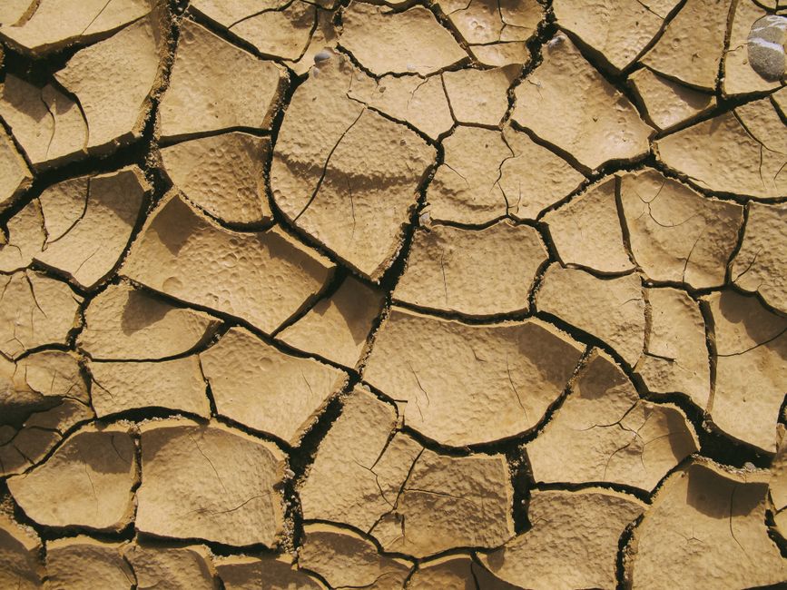
Economically, the risks are substantial. The agricultural sector, a cornerstone of the Australian economy, faces potential devastation. Reduced crop yields, livestock losses due to drought and heat stress, and increased feed costs can lead to significant financial hardship for farmers, impacting rural communities and potentially leading to higher food prices for consumers. The tourism industry could also be affected by extreme weather events and associated travel disruptions. Furthermore, the insurance industry faces increased pressure from a higher volume and severity of claims related to natural disasters, potentially leading to higher premiums or reduced coverage in high-risk areas. The cost of disaster relief and recovery efforts for government agencies would also be substantial, diverting funds from other essential services. Environmentally, the consequences can be long-lasting. Increased bushfire activity can lead to significant habitat destruction, loss of biodiversity, and soil erosion. Prolonged drought conditions can stress natural ecosystems, impacting native flora and fauna, and contributing to land degradation. Marine environments can also be affected by warmer ocean temperatures and altered ocean currents, potentially leading to coral bleaching events and impacting fisheries. The cumulative effects of a record-breaking El Niño underscore the urgent need for robust adaptation strategies and a commitment to climate resilience. For instance, investing in water-efficient infrastructure, promoting sustainable land management practices, and strengthening emergency response capabilities are vital steps in mitigating these risks and ensuring a more secure future for Australia.
How can businesses and communities prepare for an extreme El Niño event?
Preparing for an extreme El Niño event requires a multi-faceted approach that engages both businesses and communities to build resilience and mitigate potential impacts. For businesses, the first step is to conduct a thorough risk assessment specific to their industry and location. This involves identifying vulnerabilities to drought, heatwaves, bushfires, and potential supply chain disruptions. Based on this assessment, businesses can implement strategies such as diversifying water sources, investing in drought-resistant technologies, and developing robust emergency management plans that include communication protocols and business continuity measures. For the agricultural sector, this might involve exploring crop insurance options, diversifying livestock, or adopting precision farming techniques to optimise water and resource usage. Financial planning to weather potential revenue shortfalls is also critical, and accessing government support programs or grants when available is advisable.
Communities can enhance their preparedness through coordinated efforts and individual actions. Local governments play a vital role in developing and communicating emergency management plans, including evacuation routes, emergency shelter locations, and public awareness campaigns about the risks of heatwaves and bushfires. Establishing community fire-safe zones, promoting water conservation initiatives, and fostering neighbourhood support networks can significantly bolster collective resilience. Individuals should ensure they have up-to-date emergency kits, understand local bushfire risk and evacuation procedures, and monitor official warnings and advice from authorities like the Bureau of Meteorology. Engaging in local preparedness drills and workshops can also help foster a sense of shared responsibility and practical knowledge. For example, a community group in a bushfire-prone area might organise a free workshop on creating defensible spaces around homes, sharing best practices and local knowledge.

Furthermore, leveraging available resources and expert advice is paramount. The Bureau of Meteorology’s climate outlooks provide critical information for planning, while agencies like the State Emergency Service (SES) and local councils offer guidance on emergency preparedness. Businesses and community leaders should proactively engage with these agencies to stay informed and integrate their advice into local plans. The success of preparedness efforts hinges on effective communication and collaboration. Sharing information between businesses, community groups, and government agencies ensures a more cohesive and effective response when an extreme event occurs. This collaborative spirit is essential for navigating the challenges posed by a potentially record-breaking El Niño and building a more resilient future for all Australians.