
BanksiaPulse Editorial Team For more information, visit the MoneySmart savings guide. BanksiaPulse covers Australian news and finance with AI-assisted research, cross-checked against ATO, ABS, and official government sources. Published: June 16, 2026
El Niño Forecast: How Climate Change Could Amplify its Impact on Australia
This guide covers everything you need to know about El Niño Australia. Australia’s climate is set for significant disruption as the Bureau of Meteorology forecasts a strong El Niño event, potentially amplified by ongoing climate change. This impending weather pattern brings a heightened risk of extreme weather across the continent, impacting key sectors like agriculture, tourism, and insurance. Understanding these potential impacts is crucial for individuals and businesses to prepare for the challenges ahead, with early projections suggesting a drier and hotter year for much of the country. BanksiaPulse is closely monitoring these developments and their implications for the Australian economy and everyday life.
- What is El Niño and how does it affect Australia’s climate?
- How could climate change amplify El Niño’s impact on Australia?
- What are the main risks El Niño poses to Australian agriculture and water supply?
- When is the next El Niño forecast expected to impact Australia?
- What can Australian businesses and farmers do to prepare for El Niño?
- How do meteorologists forecast El Niño events before they occur?
- What historical El Niño events have caused the most damage to Australia?
The El Niño-Southern Oscillation (ENSO) is a natural climate phenomenon characterized by fluctuations in sea surface temperatures across the central and eastern tropical Pacific Ocean. During an El Niño phase, these waters warm significantly, influencing atmospheric circulation patterns globally. For Australia, this typically translates to a higher likelihood of below-average rainfall, particularly across the eastern half of the continent, and increased average temperatures. These shifts can have profound consequences, leading to drought conditions, elevated bushfire risks, and impacts on water resources. The Bureau of Meteorology’s forecast indicates a strong likelihood of these conditions materialising, signalling a period of potential environmental and economic strain.
What is El Niño and how does it affect Australia’s climate?
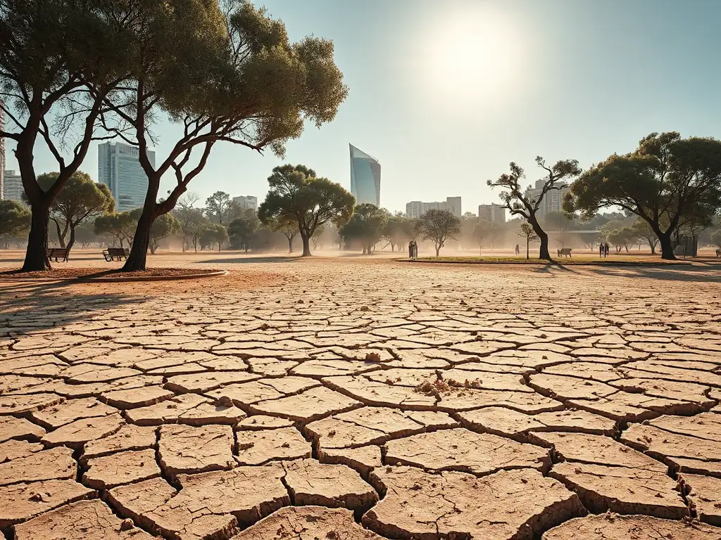
El Niño is a climate pattern that signifies a period of warming sea surface temperatures in the central and eastern tropical Pacific Ocean, fundamentally altering global weather dynamics and specifically influencing Australia’s climatic conditions. Typically, an El Niño event leads to a decrease in rainfall across much of eastern, northern, and southwestern Australia, exacerbating dry spells and increasing the risk of drought. Simultaneously, it is associated with higher average temperatures nationwide, contributing to heatwaves and increasing the potential for devastating bushfires, especially in southern Australia. For instance, historical El Niño events have often coincided with some of the nation’s most severe droughts and agricultural losses. The latest forecasts from the Bureau of Meteorology suggest a significant probability of an El Niño developing, signalling a return to conditions that have historically placed considerable stress on Australian ecosystems and industries. This pattern disrupts seasonal weather expectations, making planning for agriculture, water management, and disaster preparedness a critical concern for communities across the continent.
The climatic effects of El Niño are far-reaching within Australia. Beyond reduced rainfall and increased heat, it can influence the frequency and intensity of extreme weather events. For agricultural sectors, the implications are severe, often leading to crop failures and reduced livestock productivity due to water scarcity and heat stress. The tourism industry, heavily reliant on favourable weather conditions, can also face cancellations and reduced visitor numbers, particularly in coastal and natural attraction areas. Water catchments, vital for urban supply and irrigation, experience reduced inflow, necessitating stringent water restrictions in affected regions. This underscores the pervasive nature of El Niño’s influence, touching upon fundamental aspects of Australian life, from food security to economic stability. Understanding the mechanisms and predictability of these events is therefore paramount for effective national planning and mitigation strategies.
The scientific community utilises a range of indicators to monitor and predict El Niño events. Key among these are sea surface temperatures in specific regions of the Pacific Ocean, such as the Niño 3.4 region, which are closely observed. Atmospheric pressure patterns, including the Southern Oscillation Index (SOI), which measures the pressure difference between Tahiti and Darwin, also provide crucial insights. When the SOI is consistently negative, it indicates a higher probability of El Niño conditions. Satellite data and ocean buoy networks provide real-time measurements of ocean currents and temperature anomalies. These combined datasets allow meteorologists to assess the likelihood and potential strength of an impending El Niño event. The Bureau of Meteorology regularly updates its ENSO outlook, providing valuable information for sectors needing to prepare for potential climatic shifts. This scientific vigilance is essential for providing advance warning and enabling proactive responses.
How could climate change amplify El Niño’s impact on Australia?
Climate change is projected to amplify the impacts of El Niño events in Australia, leading to potentially more severe and widespread consequences than observed in historical patterns. As global temperatures rise due to increased greenhouse gas emissions, the background ‘hotter’ climate means that any heatwaves associated with El Niño are likely to be more intense and prolonged. Similarly, while El Niño typically reduces rainfall, climate change could exacerbate these dry conditions in some regions, pushing already water-stressed areas into more critical drought phases. This is a significant concern for the agricultural sector, where increased heat and reduced rainfall can lead to devastating crop failures and livestock losses. For example, a stronger El Niño event occurring within a warming climate could see average temperatures soar even higher than during past events, potentially reaching record-breaking levels and placing immense strain on natural resources and infrastructure. The interplay between a naturally occurring El Niño and the persistent warming trend driven by human activity creates a concerning synergy that demands careful consideration for future planning and adaptation strategies.
The amplification effect extends beyond temperature and rainfall to the frequency and intensity of extreme weather events. With a warmer atmosphere, there is more energy available, which can fuel more intense storms when they do occur, and exacerbate fire conditions. For instance, during an El Niño, increased temperatures and reduced rainfall can create drier vegetation, acting as fuel for bushfires. Climate change, by contributing to higher baseline temperatures and longer dry spells, can make these fire conditions more extreme, leading to larger and more destructive fire seasons. This increased risk necessitates enhanced bushfire preparedness measures and improved response strategies. The insurance industry is particularly vulnerable, facing rising claims due to more frequent and severe natural disasters. Understanding these amplified risks is crucial for developing more resilient infrastructure and community preparedness plans across Australia.
The economic and social ramifications of amplified El Niño impacts due to climate change are substantial. Industries heavily reliant on predictable weather, such as agriculture and tourism, face increased uncertainty and risk. For farmers, this could mean more frequent and severe crop failures, leading to reduced incomes and potential business closures. The tourism sector may experience decreased visitor numbers due to extreme weather events, such as heatwaves, bushfires, or even more intense storms in certain regions. Water security for both urban and agricultural use becomes a more pressing issue, potentially leading to stricter water restrictions and increased competition for resources. Furthermore, the increased frequency of extreme weather events can have significant public health consequences, from heat-related illnesses to respiratory issues from bushfire smoke. Therefore, proactive adaptation measures are not just environmentally prudent but economically essential for Australia’s long-term prosperity and community well-being.
What are the main risks El Niño poses to Australian agriculture and water supply?
The primary risks El Niño poses to Australian agriculture and water supply revolve around increased drought conditions, elevated temperatures, and the potential for water scarcity, significantly impacting food production and resource availability. During an El Niño event, large swathes of eastern Australia typically experience below-average rainfall, which is critical for crop growth and livestock management. This reduction in moisture can lead to widespread crop failures, particularly for rain-fed crops, and reduce the availability of pasture for grazing animals, forcing farmers to incur additional costs for supplementary feed. For example, if a strong El Niño event occurs during a critical planting season, the lack of adequate rainfall can prevent seeds from germinating or severely stunt early growth, leading to a substantial loss of yield and income for farmers. The overall impact on the agricultural sector can be devastating, affecting not only individual livelihoods but also contributing to broader food price inflation and export market disruptions.
Water supply systems across Australia are also acutely vulnerable to El Niño. Reduced rainfall directly translates to decreased inflows into dams and reservoirs, which are the primary sources of water for many urban centres and irrigation schemes. This can lead to a rapid depletion of water reserves, prompting authorities to implement stringent water restrictions for domestic use, industry, and agriculture. In areas already facing water stress, an El Niño can push systems to breaking point, necessitating emergency water management strategies. The Murray-Darling Basin, a vital agricultural region, is particularly susceptible. Reduced river flows during El Niño periods can impact irrigation allocations, affecting the viability of many horticultural and cropping enterprises that depend on this water. The downstream effects can ripple through local economies, impacting businesses that rely on the agricultural sector.
Beyond immediate agricultural and water supply concerns, El Niño’s impact on these sectors can have longer-term consequences. Persistent drought conditions can lead to land degradation, including soil erosion and loss of biodiversity, which can take years to recover. The economic strain on farming communities can lead to increased debt levels and mental health challenges for those affected. For water utilities, managing supply during prolonged dry periods requires significant investment in infrastructure and water conservation programs. The increased demand for water during hot periods, coupled with reduced supply, can also lead to higher water prices. Therefore, planning for El Niño involves not just immediate responses but also long-term strategies for drought resilience, water-use efficiency, and sustainable land management practices. These efforts are crucial for safeguarding Australia’s food security and water independence in the face of an increasingly variable climate.
Additional resources are available at the RBA official interest rate data.
When is the next El Niño forecast expected to impact Australia?
The next El Niño is forecast to have a significant impact on Australia from late 2023 into 2024, following confirmations by the Bureau of Meteorology. While the exact timing and intensity can vary, the current outlook indicates a high probability of developing conditions that align with an El Niño event. This means that Australian communities, particularly those in the eastern and southern parts of the country, should anticipate a higher likelihood of warmer and drier conditions during the upcoming seasons. The Bureau of Meteorology’s ENSO wrap-up reports, issued regularly, provide the most up-to-date information on the state of the ENSO cycle and the likelihood of El Niño. For instance, official statements have indicated a sustained increase in sea surface temperatures and changes in atmospheric patterns consistent with El Niño development, suggesting that the impacts will likely be felt across the latter half of 2023 and extend into the first half of 2024. This proactive forecasting is essential for enabling timely preparation and response across various sectors.
The development of an El Niño event typically follows a period of neutral ENSO conditions or a La Niña event, and the transition can take several months. Meteorologists monitor specific oceanic and atmospheric indicators to track this progression. Once established, El Niño’s influence on Australia is not instantaneous but rather unfolds over weeks and months, with its peak impact often felt during the spring and summer months. For farmers, this means that decisions about planting, water allocation, and fodder reserves need to be made with the anticipated drier conditions in mind. Businesses in the tourism and retail sectors might also adjust their strategies based on forecasts of potentially extreme weather, such as heatwaves, which can affect consumer behaviour and travel plans. The projected timeframe for the next El Niño suggests that vigilance and preparedness should be a priority for the coming year.
Understanding the cyclical nature of El Niño is crucial for effective long-term planning. While the current forecast points to an event within the 2023-2024 period, it’s important to note that El Niño events do not occur on a fixed schedule and can vary significantly in strength and duration. The Bureau of Meteorology uses advanced climate models and real-time observational data to provide these forecasts. For example, they might issue a “La Niña Watch” or an “El Niño Watch” when conditions are favourable for a transition to either phase. Early warnings allow governments, industries, and communities to put in place mitigation and adaptation measures, such as water conservation programs, bushfire preparedness plans, and financial support mechanisms for affected sectors. The timely dissemination of these forecasts by official bodies like the Bureau of Meteorology is a critical component of national resilience against climate variability.
What can Australian businesses and farmers do to prepare for El Niño?
Australian businesses and farmers can implement a range of proactive strategies to prepare for the anticipated impacts of an El Niño event, particularly concerning the heightened risk of drought and extreme heat. For farmers, this involves assessing water storage levels, securing supplementary feed for livestock, and considering drought-tolerant crop varieties or alternative farming practices. Diversifying farm income streams, where possible, can also provide a buffer against seasonal downturns. For example, a farmer might invest in drought-resistant pasture species or explore fodder conservation methods like silage to ensure livestock survival during dry spells. Financial preparedness is also key; securing access to credit or insurance can help mitigate losses and support recovery. Implementing robust biosecurity measures can also help protect livestock health during stressful conditions. Understanding the specific regional impacts forecasted by the Bureau of Meteorology is paramount for tailoring these preparations effectively.
For businesses, especially those in sectors vulnerable to weather disruptions like tourism, retail, and construction, preparation involves risk assessment and contingency planning. This could include reviewing supply chains for potential disruptions due to extreme weather, developing emergency response plans for staff and assets, and considering flexible work arrangements during heatwaves. For example, a construction company might schedule outdoor work during cooler parts of the day or review site safety protocols for extreme heat conditions. Businesses in drought-affected regions might need to plan for reduced local demand or consider offering services that support drought-stricken communities. For insurance providers, this involves assessing potential increases in claims related to extreme weather events and adjusting risk models accordingly. Maintaining open communication channels with suppliers, customers, and employees is crucial throughout this preparation phase.
Beyond operational adjustments, both businesses and farmers should focus on building resilience through informed decision-making and leveraging available resources. This includes staying updated on official weather forecasts and warnings from bodies like the Bureau of Meteorology and the Australian government. Exploring government assistance programs or grants designed to support drought-affected primary producers or businesses impacted by natural disasters can provide much-needed financial relief. For instance, farmers can investigate programs offered by state and federal agricultural departments that provide subsidies for water infrastructure or fodder purchasing. Building strong community networks can also be invaluable, enabling mutual support and resource sharing during challenging periods. Ultimately, a comprehensive approach that combines practical adjustments with robust financial and informational preparedness will best equip Australian enterprises to navigate the challenges posed by El Niño events.
How do meteorologists forecast El Niño events before they occur?
Meteorologists forecast El Niño events before they occur by meticulously monitoring a suite of oceanic and atmospheric indicators, a process that involves sophisticated climate modelling and real-time data analysis. The primary focus is on tracking sea surface temperatures (SSTs) in specific regions of the tropical Pacific Ocean, particularly the Niño 3.4 region, which is a key indicator of ENSO status. When SSTs in this region are consistently at least 0.5°C above average for several consecutive months, it signals the development of El Niño conditions. Complementary to SST monitoring is the analysis of atmospheric pressure patterns, most notably the Southern Oscillation Index (SOI). A sustained negative SOI, indicating higher atmospheric pressure over Darwin and lower pressure over Tahiti, is strongly associated with El Niño. These combined oceanic and atmospheric signals provide a robust basis for forecasting.
Furthermore, climate models play a crucial role in predicting the trajectory and potential strength of an ENSO event. These complex computer simulations ingest historical climate data, current oceanic conditions, and atmospheric physics to project future climate scenarios. Models can provide insights into how likely an El Niño is to develop, when it might reach its peak intensity, and how long it might persist. For example, a model might predict a 70% chance of El Niño developing by a certain month. Satellite observations, which provide broad coverage of ocean temperatures, cloud patterns, and wind speeds across the Pacific, are also vital for providing a comprehensive picture of the evolving ENSO state. Ocean buoys deployed across the Pacific Ocean continuously transmit data on temperature, currents, and other oceanographic parameters, offering crucial ground truth for the satellite and model data. This multi-faceted approach allows for increasingly accurate and timely forecasts.
The outputs of these forecasting methods are then communicated through official channels, such as the Bureau of Meteorology’s ENSO Outlook. This outlook provides a probabilistic assessment of future ENSO conditions, including the likelihood of El Niño, La Niña, or neutral conditions. It is essential for stakeholders across Australia, from farmers and water managers to emergency services and businesses, to regularly consult these official forecasts. For example, the Bureau might indicate that there is a “high chance” of El Niño developing within the next three months. This probabilistic information is invaluable for risk assessment and planning, allowing individuals and organisations to make informed decisions about resource allocation, preparedness measures, and potential mitigation strategies. The continuous refinement of these forecasting techniques is vital for improving Australia’s resilience to climate variability and extreme weather events.
What historical El Niño events have caused the most damage to Australia?
Several historical El Niño events have inflicted significant damage across Australia, profoundly impacting its economy, environment, and communities. One of the most devastating was the El Niño of 1997-98, which led to widespread drought across eastern Australia, resulting in immense agricultural losses. This event coincided with severe bushfires, particularly in Tasmania, where extensive tracts of forest were destroyed. The agricultural sector suffered billions of dollars in losses due to crop failures and reduced livestock productivity, highlighting the vulnerability of this key Australian industry to such climatic shifts. The damage extended beyond agriculture, impacting water supplies and increasing the risk of environmental degradation. The scale of the economic and social disruption during this period served as a stark reminder of El Niño’s potent influence on the Australian continent.
Another notable event was the El Niño of 2015-16, which contributed to one of the most severe droughts on record for parts of Queensland and New South Wales. This period saw critical water shortages, with many rural communities facing severe restrictions. The agricultural sector bore the brunt of this drought, with significant impacts on the cattle industry and crop yields. The intense heat associated with this El Niño also exacerbated bushfire conditions in several regions. Furthermore, the ecological impacts were substantial, affecting native wildlife and vegetation. The cumulative damage from such events underscores the long-term consequences of prolonged dry spells and extreme heat, including soil degradation and reduced biodiversity, which can take years to recover. These historical examples provide critical context for understanding the potential severity of future El Niño events.
More recently, the El Niño event of 2019-2020, while not solely responsible for the catastrophic Black Summer bushfires, significantly contributed to the extreme conditions that fuelled them. This El Niño brought prolonged hot and dry weather to southeastern Australia, creating tinderbox conditions that led to unprecedented fire activity and destruction. The fires resulted in immense ecological damage, loss of life, and widespread devastation to communities and infrastructure. The economic toll was staggering, with estimates of over $100 billion in damages. This event highlighted how El Niño, when combined with other factors like climate change, can lead to extreme weather events of unparalleled scale and impact. Understanding these historical precedents is crucial for developing effective preparedness and response strategies for future El Niño occurrences, ensuring greater resilience for Australia.